Westfield roads will undergo a digital assessment for public works to rank and prioritize future needs and projects.
In March, the Board of Public Works and Safety approved a proposal from StreetScan for an asset management program in the amount of $54,958.
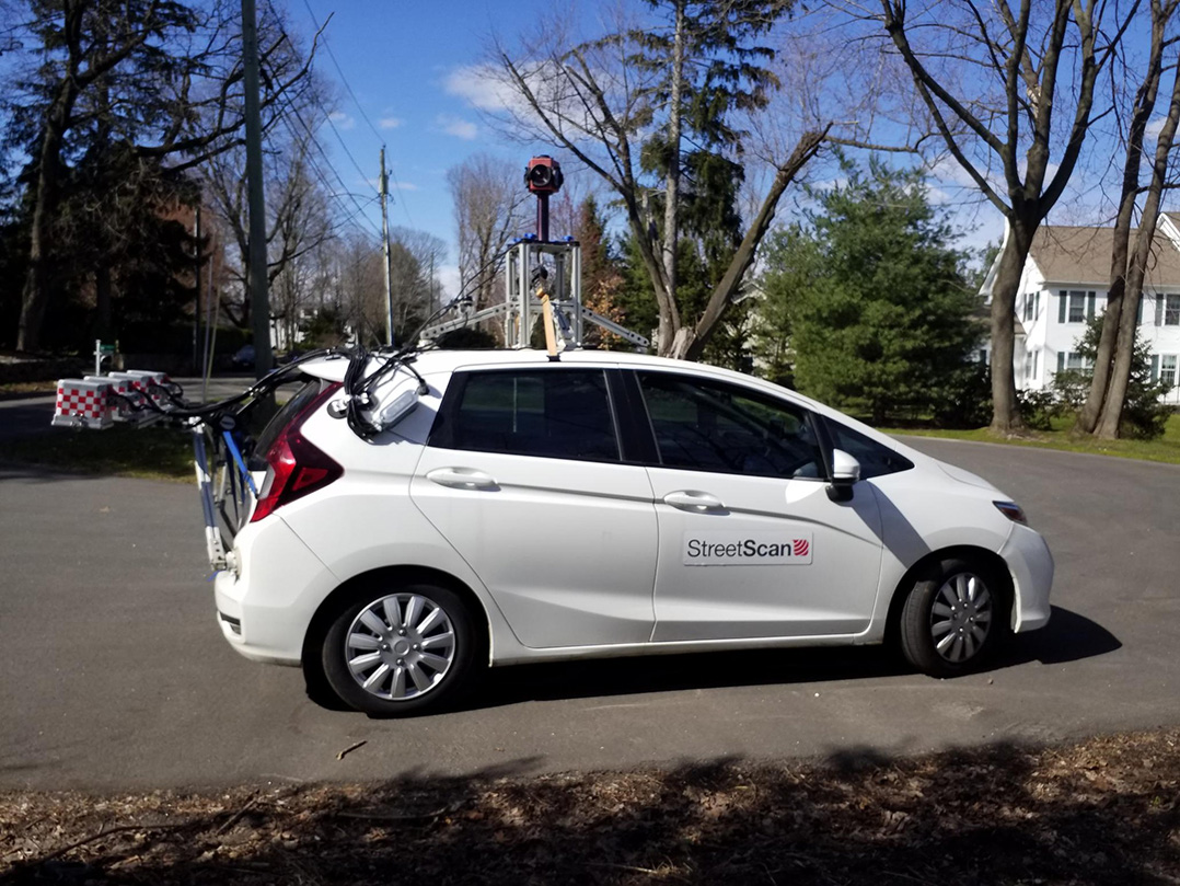
The program utilizes a specialty vehicle that travels through the city’s streets and provides 3D imagery of those roads.
“It gives us a rating condition on all of our roads,” explained city engineer Michael Pearce. “It shows locations of potholes, block cracking and all the different deficiencies we have in there. Previously we had always done that in house, but due to resources we felt like it was a good move to have a third party come in and reevaluate things. We try to do this every two years so we have a good updated condition rating on our roads. It helps us drive decision making, as far as asset management, resurfacing, crack fill, that sort of thing.”
Pearce said previously, the work was conducted by a public works employee who drove all the city streets then created a spreadsheet of those road conditions. The StreetScan system will not only provide scanning of all roads, but also asset management software that public works can use to create maps and analyze data to plan road repairs, sidewalk projects, traffic signs and right-of-way budgeting decisions.
“This is much more palatable from a research standpoint,” Pearce said. “The interface is very useful for us because not only does it provide all the condition ratings, but it also has some budget management plans in there. So, long range I can give advice to the board of public works or to council as far as what we should be spending from a pavement maintenance standpoint.”
Board members noted that the StreetScan program makes management of roads a scientific effort, versus just looking at the roads and making guesses on which streets need work at any given time.
Officials said the city also intends to have a road management portal available to the public on its website soon so residents can check street conditions.
Scanning is expected to begin in May.


