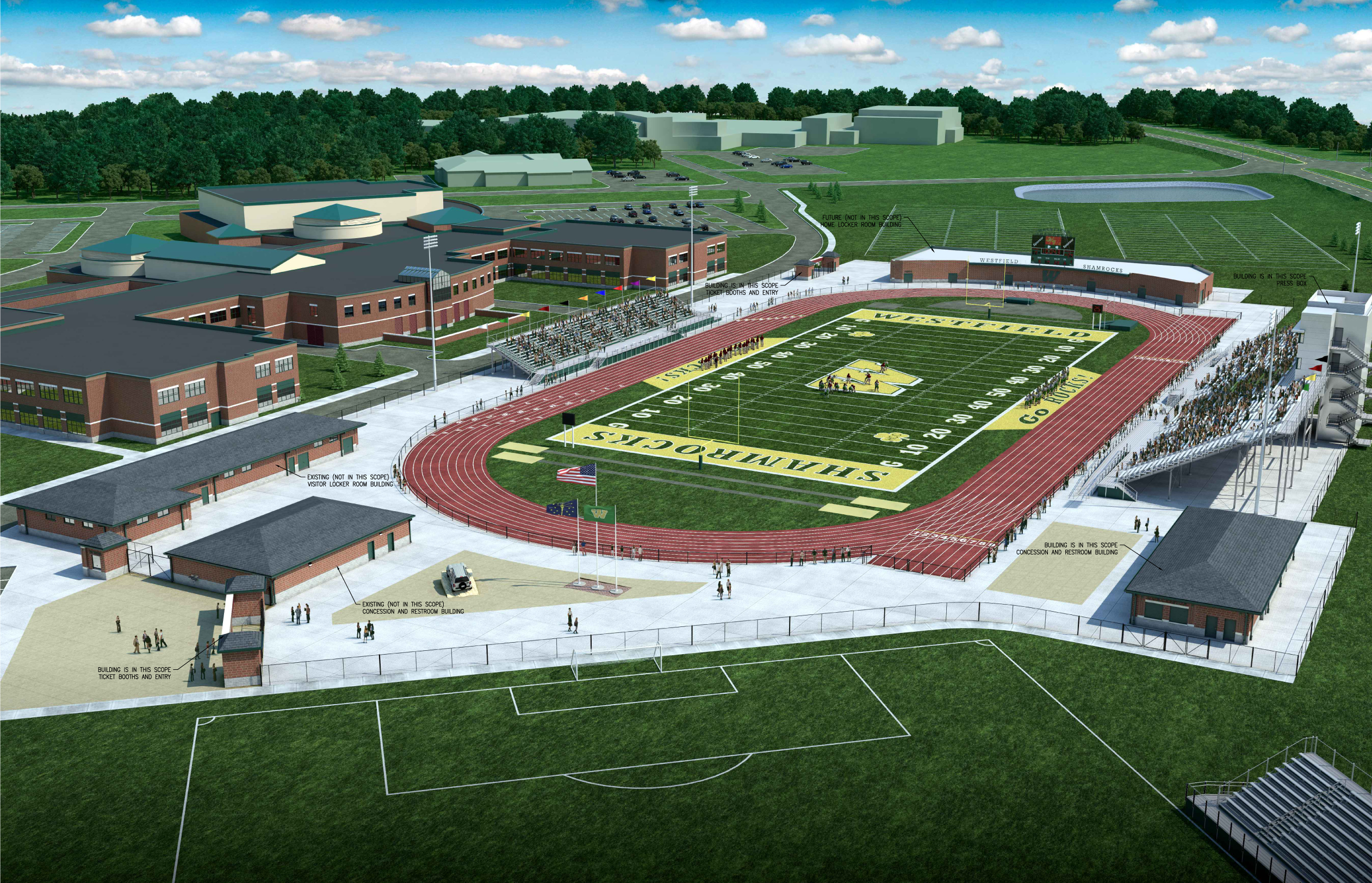
Westfield Advisory Plan Commission members received their first official look at the new proposed Westfield Community Stadium on June 2.
Westfield Washington Schools is seeking approval of a development and site plan review for a new football stadium and related improvements. The stadium will be located between the existing high school building and U.S. 31.
According to the proposal, new construction in this phase of the project includes:
• An artificial turf field
• A nine-lane running track and associated track equipment
• Stadium lights
• Concession and restroom building
• Home stands
• Visitor stands
• A two-story press box
• Four independent ticket booths
• Four foot fencing around the field and track
• Six foot fencing around the entire stadium
• Concrete pavement in all areas within the perimeter fencing
Other business conducted at the meeting included:
What happened: Development plan and primary plat approval for 136 multifamily units
What it means: The property is approximately 20 acres and is generally located 2,000 feet north of Ind. 32, abutting the east side of Casey Road. The property is currently accessed by Casey Road. While the property is zoned within the Commercial Mixed Use District, the underlying zoning is Multifamily 2. The petitioner is proposing 19 separate buildings that contain six to eight dwelling units. Amenities include a dog park and pedestrian trail.
What happened: Development plan and primary plat approval for seven duplex lots
What it means: The proposal is for seven lots for duplex buildings on approximately 2.648 acres in the North Walk development at 740 N. Union St. The proposal includes a new cul-de-sac street that is accessed from Union Street. The new street includes an emergency access lane that extends from the end of the cul-de-sac to adjacent Maple Lane. The proposal also includes two areas for neighborhood amenities and buffer yards. The property is currently vacant.
What happened: Primary plat and development plan review for 44 single family residential lots
What it means: The property is approximately 16 acres on the east side of Carey Road, south of 186th Street and north of Ind. 32. The proposed development plan is for the platting of 44 single-family detached residential lots within the existing Spring Mill Trails development.
What happened: Change in zoning for Sundown Gardens, Inc.
What it means: The petitioner requests a change from agriculture single family 1 to the Spring Mill Road/186th Street development. Sundown Gardens, 505 W. 186th St., is approximately 16 acres at the southwest corner of the intersection. The change of zoning would allow for a mixed-use agritourism, garden and lawn center, nursery and commercial development. The development ordinance establishes four areas for the business. The four proposed areas are planned to be used for garden and design, an outdoor showroom/park, market/plaza and garden area.


