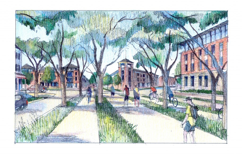
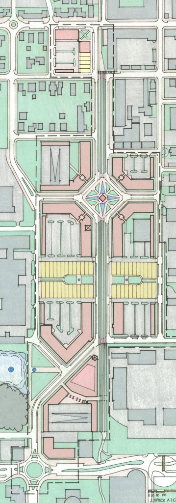
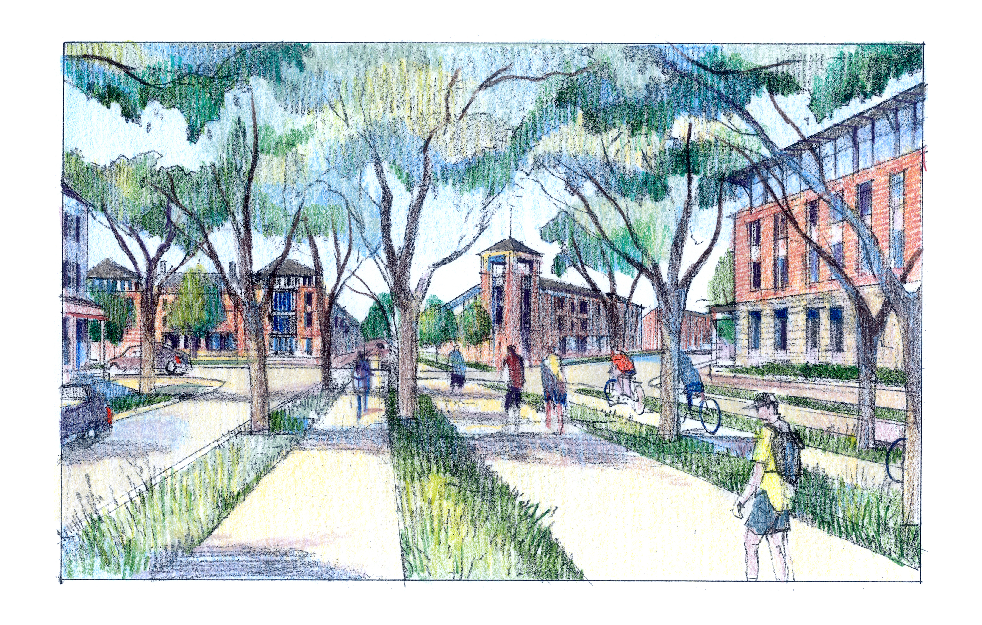
Urban planner Jeff Speck presented his plans for redeveloping the city’s Midtown area

Wednesday’s Carmel Chamber luncheon drew record attendance as urban planner Jeff Speck presented his plan for redeveloping the “Midtown” area, which is the industrial space between the Main Street Arts & Design District and the City Center, bordered to the east by Range Line Road and to the west by the single-family homes that back up to the industrial properties beyond 3rd Avenue SW. It is bisected by the Monon Trail.

A Walkable City
The goal of the plan is to create a more “walkable” city where visitors and residents can park once and then spend multiple hours in the downtown district. According to Speck, there are four basic ways to get people to walk in any urban area: give them a reason, make them feel safe, make them feel comfortable and make the walk interesting. He also believes that walkability in any city addresses economic and sustainability imperatives (he notes that residents of Manhattan have the lowest carbon footprint in the country) while lowering accident rates and improving the overall health of citizens through increased exercise.
“Carmel has already begun to create centers of walkability in the City Center and the Arts & Design District,” Speck said. “However, there is a disconnect between those spaces, and people won’t make the walk. They are walking on the Monon for recreation, but they won’t bridge the gap between these two spaces. We are so close and yet so far.”
According to Speck, various other plans for redeveloping this and other downtowns across the country have failed because they don’t address the need for parking nearby.
“Many plans have an unrealistic relationship between parking and the number and height of buildings in the area. Streets need to be driving streets. Pedestrian malls have not tended to succeed,” Speck said.
 Enlarging the Trail; Creating a “Complete Street”
The crux of the plan calls for creating a new, divided avenue on either side of what is now the Monon Trail to join Main Street and City Center Drive. The Monon Trail is currently 12 feet wide. The new “Monon Avenue” would be comprised of the following: a new, improved Monon Trail that would include separate 8-foot north and south-bound bicycle lanes with a 12-foot, two-way walking/jogging path down the center, essentially widening the trail by 16 feet. Both sides of the bicycle lanes would be flanked by north and south-bound low-speed avenues, and all sections of the avenue would be separated by 6-foot treed landscape buffers. Both the north and south-bound avenues would be 20-feet wide with parking on the outer edges and a single driving lane in each direction.
This design wherein pedestrians, bicycles and cars share a common roadway, which Speck refers to as a “complete street” concept is unprecedented, and Speck said he believes that its implementation would position Carmel as a global leader in urban planning.
Phase One of a Five Phase Plan; Street Reconfiguration
Speck’s proposal breaks down into five phases with the later phases calling for redeveloping: a second phase of Main Street, the east and west borders of the Midtown district, Mohawk Place and a plan to bring about increased walkability and new construction on Range Line Road.
In addition to the creation of the new Monon Avenue, phase one of the plan includes some reconfiguration of existing streets and the addition of two short east-west streets. The southern termination point of the new Monon Avenue would be 3rd Avenue, which would be angled to end at the northwest corner of the Mohawk Place Shopping Center. The curve at which 3rd Avenue transitions into 4th Avenue would be replaced by a turbine square, which is similar to a roundabout, but with stop signs to facilitate pedestrian crossing.
The addition of east-west roadways would be the extension of 4th Street west to 3rd Avenue and another two-block street just north of Mohawk Place. The plan also calls for a section of east-west pedestrian mews, much like the ones found in the Village of West Clay to bisect the Midtown area and create desirable green-fronted residential property with parking behind. The western end of the pedestrian mews would ideally terminate in a small but grand-scale building; perhaps a pool house or other recreational facility from a new residential development.
New Civic Landmarks; Central Square and the Watertower
The centerpiece of the plan would be a diamond-shaped area called Central Square which would house a new landmark centerpiece water tower with fountains. The existing EMT antennae would be reconfigured to be a more attractive part of the park or possibly integrated into the water tower. Additionally, the plan calls for a gateway at 1st Street to create a northern boundary for Monon Avenue and distinguish the three paths of the Monon Trail. According to the plans, the block to the northwest of the Central Square could be an ideal location for a five-story parking structure, which could be utilized by businesses during the day and residents at night.
Potential Cost to be Determined
The cost of the potential implementation of these plans has not been determined.
“We are working with engineering firm RW Armstrong to create a preliminary engineering plan,” Speck said.
The potential estimated costs, their impact on the city’s budget and the use of TIF funds to help finance the development are all sources of hot debate among city council members and the mayor. Individual council members’ positions on the subject, along with the views of Midtown-area residents and business will be presented in a series of articles to come.


